
2025
Comparably’s Best Company Outlook
* Providing engineering services in these locations through SWCA Environmental Consulting & Engineering, Inc., an affiliate of SWCA.

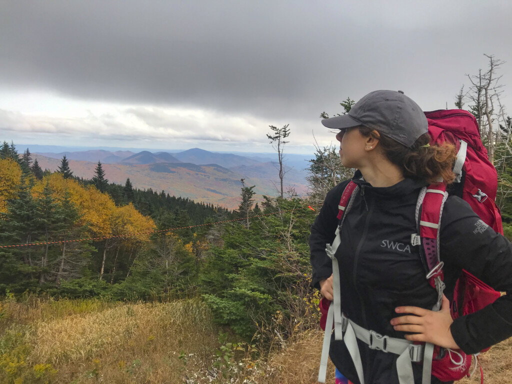
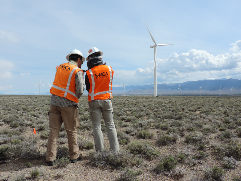
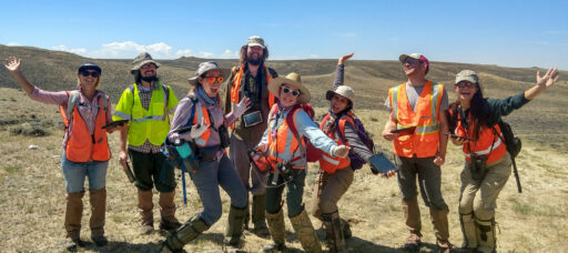
From the experts we hire, to the clients we partner with, our greatest opportunity for success lies in our ability to bring the best team together for every project.
That’s why:
At SWCA, sustainability means balancing humanity’s social, economic, and environmental needs to provide a healthy planet for future generations.
SWCA employs smart, talented, problem-solvers dedicated to our purpose of preserving natural and cultural resources for tomorrow while enabling projects that benefit people today.
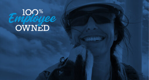
At SWCA, you’re not just an employee. You’re an owner. Everyone you work with has a stake in your success, so your hard work pays off – for the clients, for the company, and for your retirement goals.
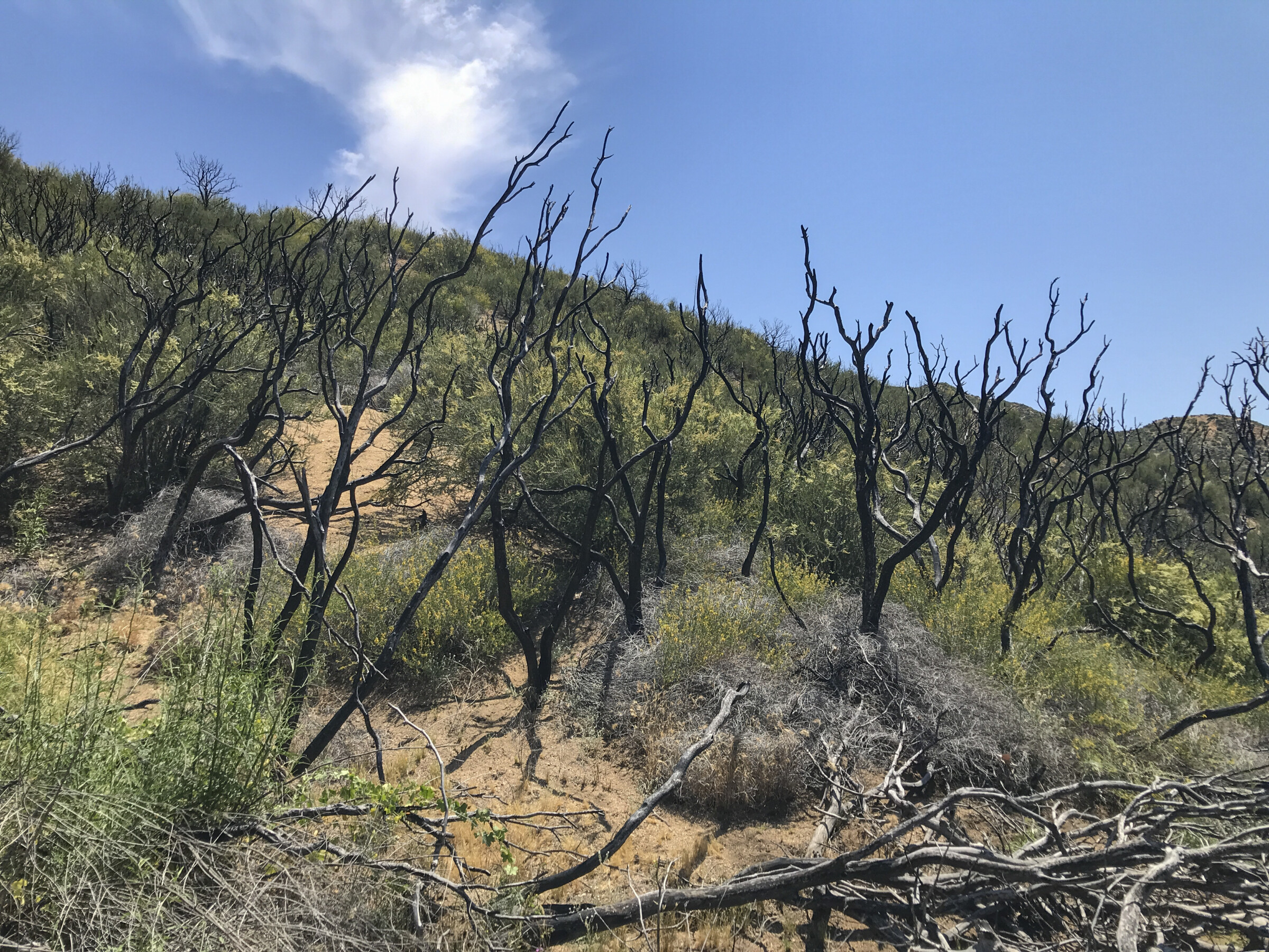
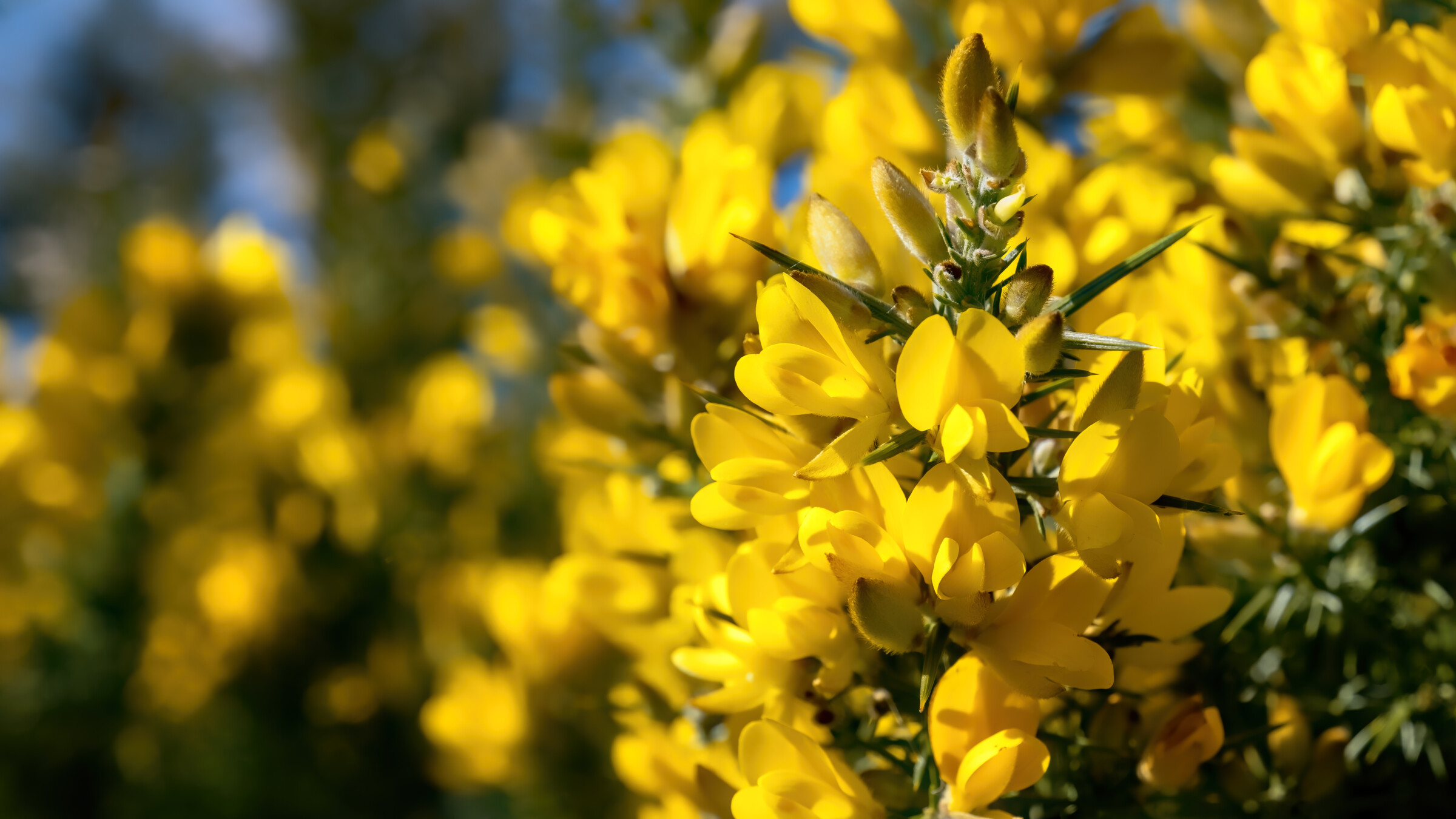
Mapping Gorse, Protecting Communities: How SWCA Used Sound Science and Creative Solutions to Tackle Wildfire Risk in Oregon
Victoria has a background in forestry, fire ecology, and natural resource management and has managed and developed over 100 CWPPs and Fire Management Plans. She started with SWCA in early 2007 and now leads the company’s fire and forestry team.

Joshua uses spatial data science and geographic information systems to develop cutting-edge workflows. He uses the latest technology including artificial intelligence, spatial analysis, network analysis, the use of computer programming languages, and much more. He also develops and facilitates utility-scale renewable energy projects as a Land Development Specialist.
Joshua was also named the 2024 Second Quarter Lawrence S. Semo Scientific Achievement Award winner.

Dani Ryder began her journey with SWCA as a summer 2025 intern in Colorado, where she had the opportunity to connect with some of the local staff. She now serves as a Marketing Assistant, focusing on internal communications and sharing stories from across the company. Originally from Boulder, Colorado, Dani is a student at the University of Arizona, majoring in journalism with a minor in marketing, and is set to graduate in spring 2026.


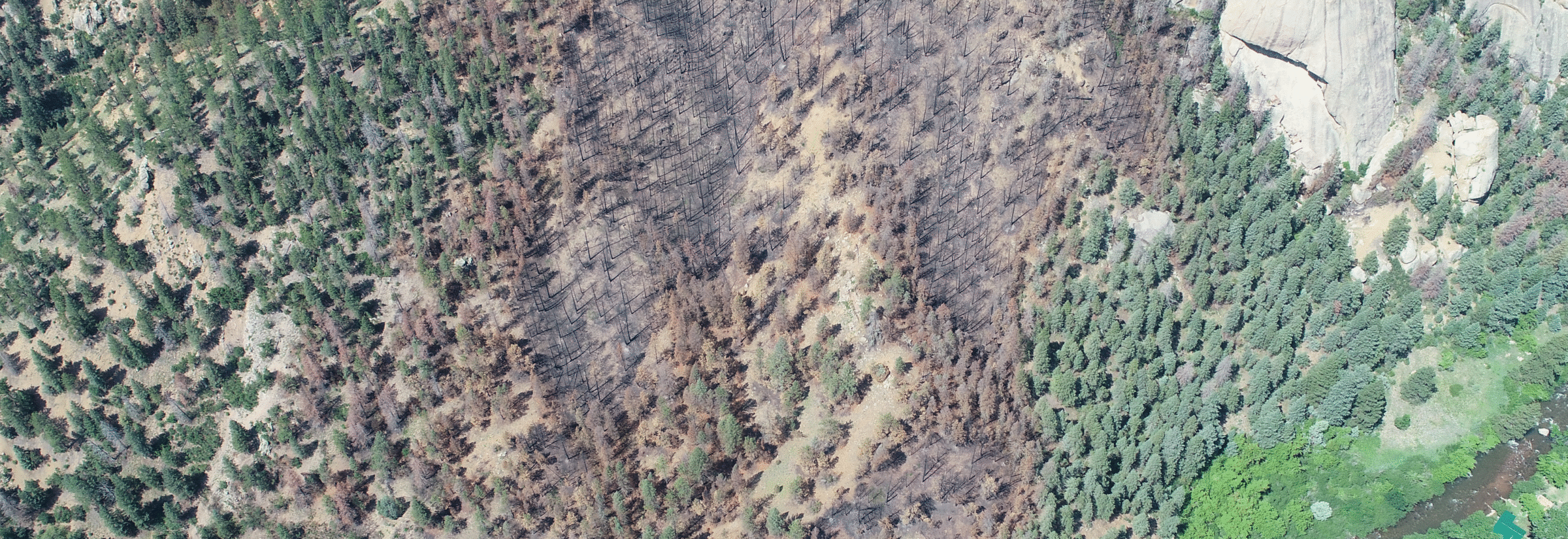
Wildfire seasons are growing longer and more intense across the American West due in large part to changing climate and arid conditions. But in Curry County, Oregon, a different kind of threat is also fueling wildfire concern: gorse (Ulex). This spiny, highly flammable shrub, once rare in the Pacific Northwest, has invaded thousands of acres along the coast, turning lush, scenic landscapes into potential wildfire hotspots.
“Gorse is like gasoline…it’s highly flammable,” said Victoria Amato, a principal planner of fire and forestry at SWCA. “It’s a non-native species invading large areas of Curry County, and it’s pretty prevalent now along the Oregon coast.” Left unchecked, gorse not only increases the risk of catastrophic wildfires, but it also complicates fire modeling and response efforts, leaving communities more vulnerable than they may appear on paper.
For years, land managers, fire agencies, and conservation advocates struggled with a fundamental challenge: accurately mapping gorse infestations. Without reliable data, it was very difficult to assess risk, prioritize treatment, or apply for funding.
“One of the issues for land managers is a lack of good mapping for where gorse infestation has occurred in the county,” Amato explained. “When the fuel models are not calibrated to the extent of the gorse, it makes it appear, inaccurately, that these areas have very low fire risk.”
In 2023, SWCA stepped in to help turn the tide. Erin Munster, a leader with the Curry County Soil and Water Conservation District and a driving force behind the Gorse Action Group, reached out to SWCA with a challenge: Could advanced technology help solve a longstanding local problem? With remaining funds from the county’s Community Wildfire Protection Plan (CWPP), SWCA partnered with local stakeholders to build a solution tailored to the region’s needs. As Amato recalled, “This wasn’t a situation where SWCA came along and said, we have a solution for you—Erin had already done a lot of work on her own. It was a real collaborative opportunity for us to deliver on our company tagline of ‘creative solutions’ for a problem identified by a client.”
SWCA’s Senior Data Scientist, Josh Bailey, applied modern machine learning techniques to decades-old aerial imagery, breathing new life into a dataset that had once yielded only limited results. “We applied what they were already trying to do, but with the most recent methods, and demonstrated that it was very effective,” said Bailey. “It was really promising.” Bailey began with a classic remote sensing approach using the Normalized Difference Vegetation Index (NDVI), then layered in custom-built AI tools he trained to distinguish gorse from similar vegetation.
What made the project especially successful was the close collaboration between SWCA scientists and the local community. Amato, Bailey, and Munster all reviewed the AI outputs in real time, helping to fine-tune the model and ensure accuracy of the final map.
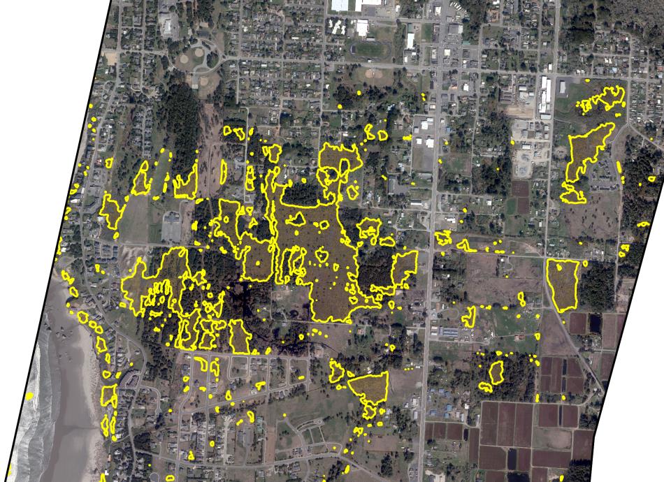
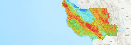
The output maps showcase the results of the computer vision model. The model effectively delineates gorse boundaries and distinguishes it from other vegetation types. The 4-band imagery provided continuous outputs with well-defined outlines, highlighting its effectiveness
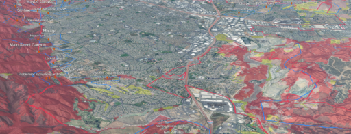
By early 2025, SWCA helped deliver something new: a detailed, highly accurate map showing where gorse concentrates in Curry County and neighboring Coos County. Fire agencies will have the opportunity to calibrate their models to reflect real-world risk, land managers will have a tool to help prioritize the most urgent treatment areas, and community leaders will be able to strengthen their applications for wildfire mitigation funding. “Erin’s goal is to show more accurate assessment of wildfire risk, and that really requires this calibration,” Amato noted.
As for community leader Erin Munster and the Gorse Action Group, the impact of this project will extend beyond just fire modeling. Erin will be able to use the updated maps to track gorse treatments over time, measure progress, and demonstrate impact to funders, making it easier to stretch limited resources for maximum effect. What began as a local need has the potential to be a regional success story, that leverages strong collaboration and a shared commitment to innovation.
“It was just a really good project case study… testing out our capabilities and seeing highly effective results that have the ability to make a big impact,” said Amato. “It was a great partnership.” Bailey echoed that sentiment.
Looking ahead, the team hopes to build on this success by adapting the model for use in other regions where gorse is spreading; reaching as far as Hawai’i and the United Kingdom. “I’d love to be able to connect those dots,” Amato said. “Since SWCA works across different regions of the country as well as globally, I’d love to bring some of these resources to other areas and exchange knowledge on this topic.”
By combining technical innovation, local engagement, and a commitment to creative solutions, SWCA helped Curry County transform a persistent hazard into an opportunity for smarter planning and greater resilience. This project is a testament to what’s possible when sound science, strategy, and partnership come together to tackle complex environmental challenges.
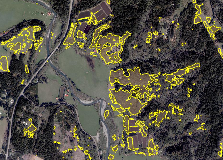
The output maps showcase the results of the computer vision model. The model effectively delineates gorse boundaries and distinguishes it from other vegetation types. The 4-band imagery provided continuous outputs with well-defined outlines, highlighting its effectiveness