To make the best decisions, you need accurate and up-to-date data that is readily available to your project team.
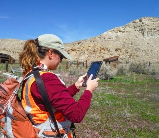
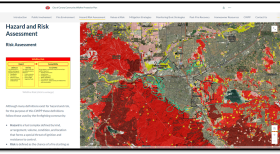
SWCA’s enterprise Geographic Information System (GIS) platform — including web and mobile services — enables secure data sharing across the organization in real time, allowing managers to remotely monitor fieldwork results and helping decision-makers respond quickly to new information. You no longer have to guess or imagine how your finished project site will look. With spatial modeling tools that simulate real-world conditions, SWCA can accurately “predict” the visual aspect of project outcomes.
With an integrated staff of geospatial data and information technology professionals, our comprehensive services include GIS, GPS, database management, and custom web and mobile application development. In addition to the use of industry-standard software platforms, SWCA leverages the latest commercial and open-source development tools for the web, Android devices, and the iOS platform to develop custom applications to support your project needs.
Relevant Services
- Data Management and Integration
- GIS Design, Development, and Implementation
- GIS Database Design, Implementation, and Management
- Web / Mobile GIS Design and Custom Application Development
- Data Mining and Spatial Data Acquisition
- GPS Custom Form Development, Data Collection, and Post-Processing
- LiDAR Data Acquisition, Analysis, and Mapping
- Drone Data Capture
- Remote Sensing and Image Processing
- AutoCAD Computer-Aided Design (CAD)
- Spatial Analysis and 3D Modeling
- Linear Corridor Siting and Routing
- Impact Assessment and Mitigation Planning
- 3D Mapping and Visualization
- Visual Simulations and Resource Inventories
- Land Use Planning
- Site Suitability Analysis
- Geo-Statistical Analysis
- Land Cover and Vegetation Mapping
- Wildlife Habitat, Cultural Resources, and Wetland Mapping
- Wildfire Hazard Data Collection, Analysis, and Modeling
- Wind Farm Planning and Siting
- Statistical Analysis and Modeling
- Comprehensive Research Planning
- Geospatial analysis
- Cartography
- Onsite Wastewater Risk Mapping

